
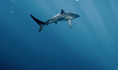
Satellites being used to help critically endangered whales
The North Atlantic right whale is critically endangered with only about 336 known to be in existence.

By Pol Allingham via SWNS
Powerful space satellites that can identify individual whales from their markings have been used for the first time to track a critically endangered species.
Scientists are using the tech to follow the North Atlantic right whale to keep them away from ships and find out where they go in the summer and fall.
The latest satellites are able to capture finer images than Google Earth, meaning conservationists can identify species and even individuals.
Knowing where the whales are at any given time enables fisheries to open or close to avoid the whales and enables ships to bypass them to prevent collisions and deaths of the beasts.

The team successfully spotted “Ruffian," a Gulf of St. Lawrence North Atlantic right whale who has a large white scar across his back after being severely injured in an entanglement with fishing gear in 2008.
Matus Hodel, a Ph.D. student at the University of Ottawa who ran the study, explained how this can be used to improve conservation efforts.
Mr. Hodul said: “The North Atlantic right whale is critically endangered, with about 336 individual whales accounted for."
“Mortality comes from whales being hit by ships and becoming entangled in fishing gear, so being able to detect and monitor their location is important to conservation efforts.
Writing in the journal Marine Mammal Science researchers said the technology will help them save the majestic creatures from injury and death.
Mr. Hodul said: “This is a new type of satellite imagery which has a spatial resolution of 15 cm, which means each pixel in the image represents 15 cm on the ground.

"For context, this is much finer than Google Earth satellite images.
“This imagery allows us to find the endangered North Atlantic right whales and confidently differentiate this species from other kinds of whales, such as fin whales and humpbacks.
“In some cases, it also allows us to identify individual whales, in circumstances where a whale has sufficiently distinct markings.
“Interestingly, it is not known where approximately 50% of North Atlantic right whales go in the summer and autumn months.
“Now that we can detect and positively identify right whales using satellite imagery, it will likely have significant implications for conservation efforts.
“We were able to identify the whale named “Ruffian,” who was severely injured in an entanglement with fishing gear in 2008 that left him with a distinct, large white scar on his back.
"In the satellite imagery, we were able to spot a right whale with this exact scar, allowing us to identify the whale as Ruffian.”
From April 2021 to late summer 2022 the University of Ottawa team conducted aerial surveys to locate and photograph the whales.
In the months after the survey they located the whales using satellite imagery.
The Canadian Space Agency, Department of Fisheries and Oceans, and Transport Canda all helped finance the project.
It's a part of the Canadian Space Agency's wider smartWhales initiative to explore ways to detect the North Atlantic right whales using space tech.
Stories and infographics by ‘Talker Research’ are available to download & ready to use. Stories and videos by ‘Talker News’ are managed by SWNS. To license content for editorial or commercial use and to see the full scope of SWNS content, please email [email protected] or submit an inquiry via our contact form.


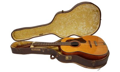

John Lennon’s lost ‘Help!’ guitar to break auction records
The iconic guitar is expected to fetch between $600,000 and $800,000.


Scientists clone two black-footed ferrets to save endangered species
The black-footed ferret is one of North America’s most endangered mammals.


Flight attendant reveals her top flight and travel tips
She has been a flight attendant for six years and traveled to 44 countries on thousands of flights.


How much is tipflation costing Americans every year?
Americans are spending much more on tipping than they want to.


Majority of American moms and dads feel lonely and burned out
And over 60% say they are burned out by their responsibilities as a parent.

 Parenting5 days ago
Single mom details struggles of feeding her 12 kids

 Lifestyle4 days ago
Woman regrets her tattoo nightmare: ‘It’s horrendous’

 Broadcast1 week ago
Over 40% of Americans have no clue what a 401k is

 Broadcast6 days ago
How hard is it for Americans to live sustainably?
- Money1 week ago
Over 40% of Americans have no clue what a 401k is

 Environment6 days ago
How hard is it for Americans to live sustainably?

 Pets1 week ago
Most cat owners know very little about their feline friends

 Health1 day ago
New study reveals ‘old age’ begins later than it used to